SkyTracker

SkyTracker gives authorized shore-based users a consolidated operational view of Alon-connected marine assets. Its browser-based interface brings together current and historical vessel information, events, alerts, communications, traceability records, and map-based operational data.

Fleet visibility. Operational context. Shore-side coordination.

Fleet Visibility and Data

Flexible vessel views, historical review, event filtering, and export tools help authorized users monitor fleets and investigate activity.

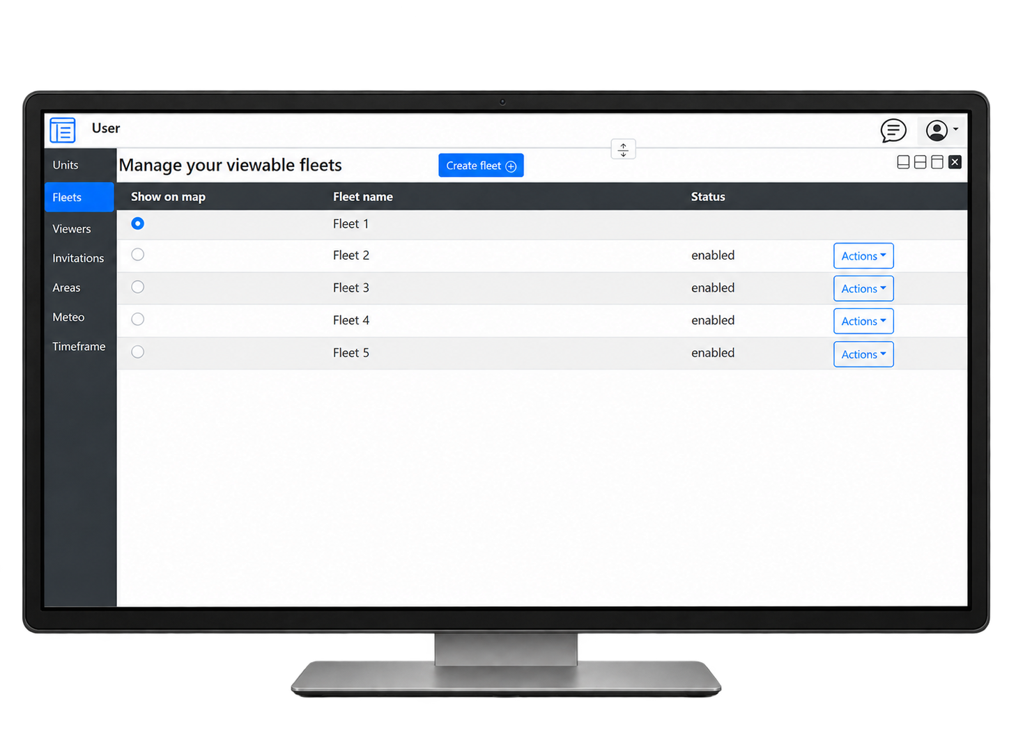
Fleet Management

Flexible vessel grouping and historical review

  • Organize vessels into fleets or operational groups for simplified monitoring and management.
  • Display a single vessel, a selected fleet, or all authorized vessels.
  • Review recent activity using predefined time ranges covering the latest positions, hours, days, or weeks.
  • Select custom date and time ranges for detailed historical review.
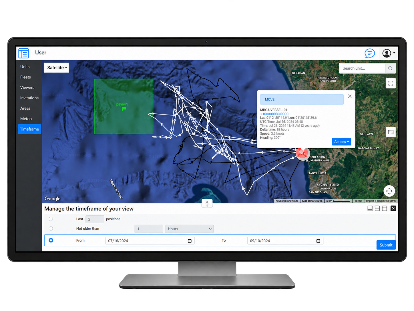
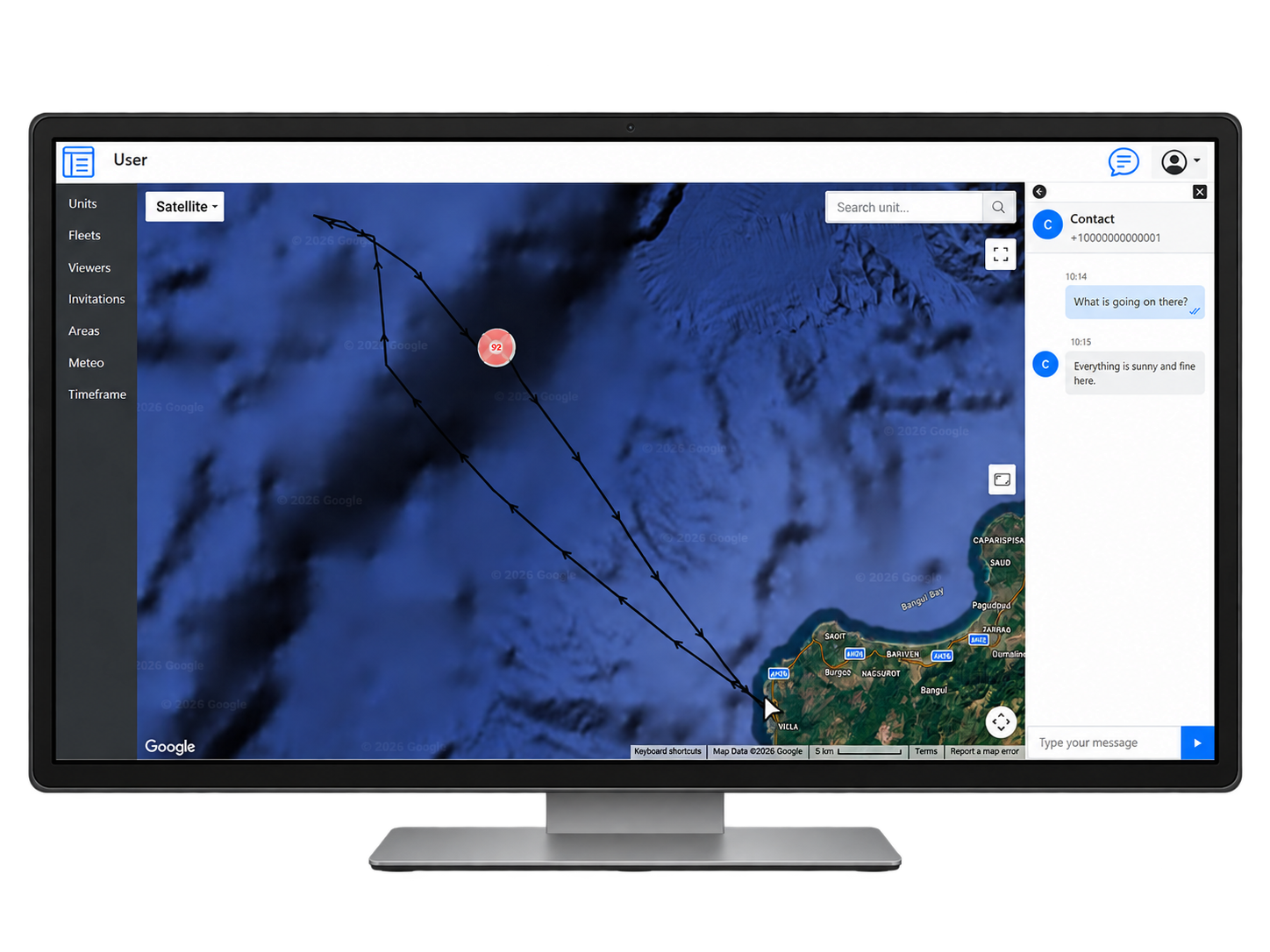
SkyTracker vessel position map
SkyTracker fleet management view

Data Visualization and Management

Map-based filtering, tracks, and data export

  • Display and categorize units by colour for quick identification.
  • Filter events by event type, date, or operational category to support investigation and analysis.
  • Use distinct map icons to identify events, Hotline incidents, fish-catch locations, RFID tag records, and other activities.
  • Review historical vessel tracks together with the events that occurred along each route.
  • Export authorized data for reporting, analysis, or import into other applications.

Messaging and Map Overlays

Two-way vessel communication and configurable map layers support routine operations, incident coordination, and environmental awareness.

Messaging

Two-way coordination with vessels at sea

  • Send and receive two-way messages between authorized shore users and Alon-equipped vessels.
  • Coordinate Hotline incidents using configurable incident types and map icons.
  • Maintain two-way communication with the reporting vessel during an active Hotline event.
  • Use vessel position and nearby fleet information to support operational or emergency response.
SkyTracker vessel messaging interface

Overlays

Environmental intelligence and custom operational zones

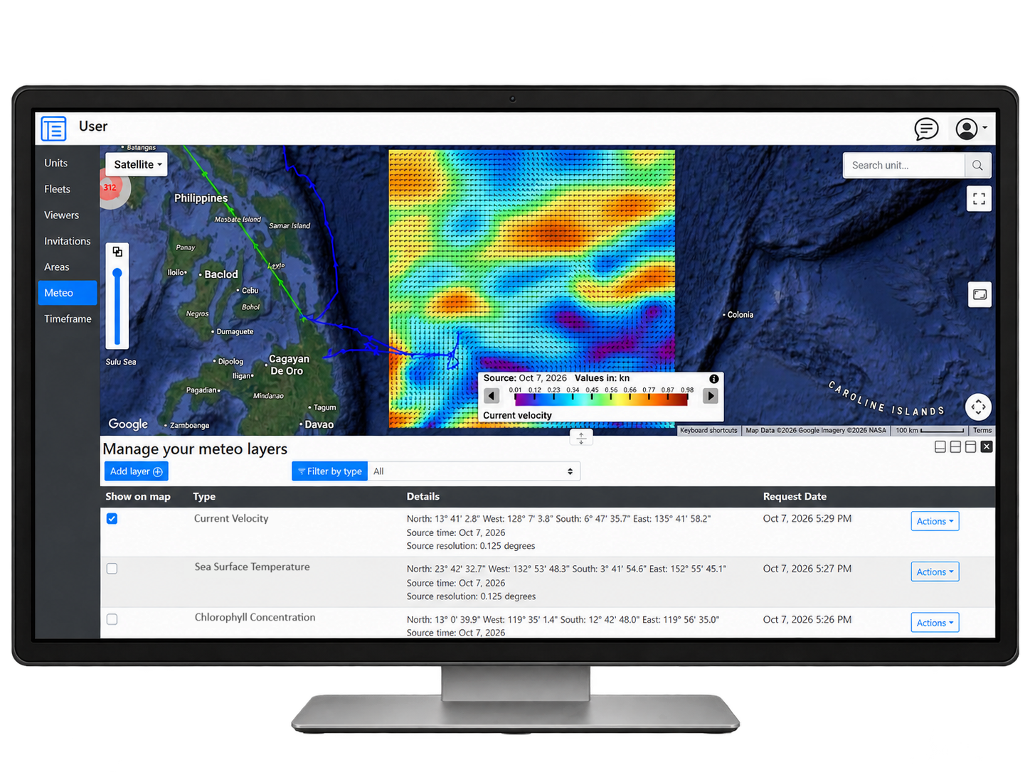
  • Access global high-definition, cloud-free sea-surface-temperature and chlorophyll data, ocean-current velocity and direction, current height, and altimetry overlays to identify temperature boundaries, productive waters, currents, eddies, upwelling areas, and other conditions associated with potential fishing locations.
  • Access marine-weather forecasts using the Beaufort Wind Force Scale.
  • Create and display polygonal, circular, or linear areas, including exclusive economic zones, marine protected areas, ports, aquaculture farms, regulatory boundaries, and other custom zones.
SkyTracker sea-state map overlay